

Class: Senior Secondary School 1 (SS1, SS 1, SSS1, SSS 1)
Term: Second Term
Week: 4
Age: 15 years
Duration: 45 minutes
Subject: Geography
Curriculum Theme: Geography
Previous Lesson: Factors Affecting Climate.
Topic: GEOGRAPHY OF NIGERIA
Subject Matter: location and position of Nigeria, size and distance using latitudes and longitudes, boundaries and neighbouring countries, political divisions of Nigeria, states and their capitals, local governments and their headquarters
Specific Objectives
By the end of the lesson, pupils should be able to:
Cognitive Domain:
- Define the geographical location and position of Nigeria using latitudes and longitudes.
- State the approximate size and distance of Nigeria.
- List Nigeria’s neighbouring countries and describe its boundaries.
- Identify the main political divisions of Nigeria.
- Mention at least five states and their capitals.
- Explain the concept of local governments and their headquarters.
Affective Domain:
- Appreciate the diverse geographical features and political structure of Nigeria.
- Develop an interest in learning more about Nigeria’s geography.
Psychomotor Domain:
- Locate Nigeria on a world map or globe.
- Draw a sketch map of Nigeria showing its boundaries and some neighbouring countries.
Social Domain:
- Collaborate with peers to identify states and capitals on a map.
Reference Materials
The following resources were used in planning this lesson:
- 9 Years Basic Education Curriculum for Senior Secondary Schools (Geography).
- State Unified Scheme of Work for Geography SSS 1.
- Adeleke, B.O. & Leong, G.C. (2012). Certificate Physical and Human Geography for Senior Secondary Schools. Africana First Publishers Plc.
- Atlas.
Instructional Materials
The teacher will teach this lesson with the aid of:
- Political maps of Nigeria.
- A globe.
- Illustrative diagrams showing Nigeria’s position.
- An atlas.
Rationale for the Lesson
Understanding Nigeria’s geography helps pupils appreciate their country’s physical and human diversity. It also provides a foundation for understanding current events and national development issues, enabling them to make sense of their environment.
Prerequisite/Previous Knowledge
Pupils have basic knowledge of maps, continents, and the concept of countries from their Junior Secondary School Geography lessons.
Lesson Content/Board Summary
GEOGRAPHY OF NIGERIA
Location and Position of Nigeria
Nigeria is located in West Africa, on the coast of the Gulf of Guinea. Its position is defined by latitudes 4°N and 14°N of the Equator, and longitudes 3°E and 15°E of the Greenwich Meridian.
Size and Distance of Nigeria
Nigeria covers a total land area of approximately 923,768 square kilometers. Its greatest east-west extent is about 1,300 km, and its greatest north-south extent is about 1,050 km.
Boundaries and Neighbouring Countries
Nigeria shares land boundaries with several countries and a maritime boundary with the Atlantic Ocean.
The following are Nigeria’s neighbouring countries:
- Benin Republic (to the west)
- Niger Republic (to the north)
- Chad (to the north-east)
- Cameroon (to the east)
Political Divisions of Nigeria
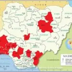
Nigeria is a federal republic divided into states, a Federal Capital Territory (FCT), and Local Government Areas (LGAs).
- States: There are 36 states in Nigeria.
- Federal Capital Territory (FCT): Abuja is the Federal Capital Territory.
- Local Government Areas (LGAs): There are 774 Local Government Areas in Nigeria.
States and their Capitals
Each state in Nigeria has a capital city where the state government is headquartered.
The following are examples of states and their capitals:
- Abia State – Umuahia
- Lagos State – Ikeja
- Kano State – Kano
- Rivers State – Port Harcourt
- Enugu State – Enugu
- Oyo State – Ibadan
Local Governments and their Headquarters
Local Government Areas are the third tier of government in Nigeria, responsible for local administration and development. Each LGA has a headquarters town.
The following are examples of local governments and their headquarters:
- Agege LGA (Lagos State) – Agege
- Abuja Municipal Area Council (FCT) – Garki
- Fagge LGA (Kano State) – Fagge
Teaching Methods/Instructional Techniques
Discussion, Lecture, Demonstration, Question and Answer, Visual Aids
Instructional Procedures
Step 1: Introduction
Time: 5 minutes
Teaching Skill: Set Induction
Teacher’s Activity: The teacher greets the pupils and asks them to mention their state of origin and its capital. The teacher then displays a world map/globe and asks pupils to locate Nigeria.
Pupils’ Activity: Pupils respond to the teacher’s questions and attempt to locate Nigeria on the map/globe.
Learning Point: Pupils recall prior knowledge of Nigeria and its location.
Step 2: Presentation of Nigeria’s Location and Position
Time: 10 minutes
Teaching Skill: Explanation/Demonstration
Teacher’s Activity: The teacher uses the political map of Nigeria and a globe to explain Nigeria’s location in West Africa. The teacher then defines Nigeria’s position using latitudes (4°N to 14°N) and longitudes (3°E to 15°E) and demonstrates these on the globe.
Pupils’ Activity: Pupils observe the maps and globe, listen attentively, and take notes on Nigeria’s location and geographical coordinates.
Learning Point: Pupils understand how to define Nigeria’s location using latitude and longitude.
Step 3: Discussion on Size and Boundaries
Time: 7 minutes
Teaching Skill: Discussion/Questioning
Teacher’s Activity: The teacher leads a discussion on the approximate land area of Nigeria and its greatest extent. The teacher then guides pupils to identify and list Nigeria’s neighbouring countries and discuss the nature of its boundaries.
Pupils’ Activity: Pupils participate in the discussion, state the size of Nigeria, and list the neighbouring countries.
Learning Point: Pupils can state Nigeria’s size and identify its neighbours.
Step 4: Explanation of Political Divisions
Time: 7 minutes
Teaching Skill: Explanation
Teacher’s Activity: The teacher explains that Nigeria is divided into 36 states, the Federal Capital Territory (FCT), and 774 Local Government Areas. The teacher emphasizes that these divisions help in administration and governance.
Pupils’ Activity: Pupils listen and take notes on the political divisions of Nigeria.
Learning Point: Pupils understand the administrative structure of Nigeria.
Step 5: Identification of States and Capitals
Time: 7 minutes
Teaching Skill: Guided Practice
Teacher’s Activity: The teacher displays a political map of Nigeria showing states and their capitals. The teacher calls on pupils to identify different states and their capitals on the map. The teacher may mention some examples for clarity.
Pupils’ Activity: Pupils take turns identifying states and their capitals on the map and write down examples in their notebooks.
Learning Point: Pupils can identify various Nigerian states and their capitals.
Step 6: Understanding Local Governments
Time: 4 minutes
Teaching Skill: Elaboration
Teacher’s Activity: The teacher further explains the role of Local Government Areas as the closest tier of government to the people. The teacher gives examples of LGAs and their headquarters, relating it to their own locality if possible.
Pupils’ Activity: Pupils listen and ask questions for clarification about LGAs and their headquarters.
Learning Point: Pupils grasp the concept and importance of local governments.
Step 7: Evaluation/Review
Time: 5 minutes
Teaching Skill: Questioning/Assessment
Teacher’s Activity: The teacher evaluates the learning by asking the following questions:
- Define the geographical location of Nigeria using latitudes and longitudes.
- List any three countries that share a land boundary with Nigeria.
- Mention the main political divisions of Nigeria.
- Name the capital of Lagos State and Kano State.
Pupils’ Activity: Pupils answer orally and in writing.
Learning Point: Pupils demonstrate understanding of the lesson.
Step 8: Conclusion
Time: 5 minutes
Teaching Skill: Summarization/Assignment
Teacher’s Activity: The teacher summarizes the key points of the lesson, reinforcing Nigeria’s location, size, boundaries, and political structure. The teacher then gives homework: “Draw a sketch map of Nigeria, showing its four cardinal neighbours and the Federal Capital Territory.”
Pupils’ Activity: Pupils listen to the summary and copy down the homework.
Learning Point: Pupils consolidate their learning and prepare for further study.
Lesson Keywords
- Latitude – Imaginary lines running east-west, parallel to the Equator, used to measure distance north or south.
- Longitude – Imaginary lines running north-south, from pole to pole, used to measure distance east or west of the Prime Meridian.
- Boundary – A line that marks the limits of an area; a dividing line.
- State – A major political division within a federal country.
- Capital – The city or town that functions as the seat of government and administrative centre of a country or state.
- Local Government Area (LGA) – The third tier of government in Nigeria, responsible for local administration.
Differentiation
For visual learners, the teacher will make extensive use of political maps, globes, and diagrams. For pupils who may struggle, the teacher will provide simplified notes and encourage peer support during map activities. More advanced pupils will be challenged to research specific geographical features or economic activities in different states.
Note for teachers using this lesson plan
Teachers should ensure that pupils actively participate in identifying locations on maps. Encourage discussions about the importance of knowing Nigeria’s geography for understanding its development and challenges. Emphasize drawing skills and map interpretation throughout the lesson.



Community Join the conversation Open discussion +