

Note for teachers using this lesson plan
This lesson introduces Senior Secondary 1 students to essential tools used in Geography. Teachers should prepare by gathering visual aids such as actual maps, an atlas, a globe, a compass, and images or short video clips demonstrating GIS and remote sensing applications. Emphasise the practical utility of each tool and encourage students to relate them to real-world scenarios. By the end of the lesson, students should be able to identify and briefly describe the function of various geographic tools.
Class: SS 1
Term: First Term
Week: 2
Age: 15 years
Duration: 60 minutes
Subject: Geography
Curriculum Theme: Understanding Geography and
Focal competence: Using Geographic Concepts and Tools to Interact with the Environment
Key competencies/values: Communication; Collaboration; Environmental Literacy; Responsibility
Skills:
- Identifying basic geographic tools
Previous Lesson: Geography, Physical, Human, Regional and Practical Branches
Topic: Concept Of Geography: Tools Of Geography
Subject Matter: Tools of geography, atlas, globe, compass, geographic information systems, remote sensing, etc
Specific Objectives
By the end of the lesson, pupils/students should be able to:
Cognitive Domain
- Identify basic geographic tools such as maps, atlases, globes, and compasses.
- Explain the basic function of Geographic Information Systems (GIS).
- Describe the concept of remote sensing.
Affective Domain
- Appreciate the importance of geographic tools in understanding the environment.
- Show interest in learning more about advanced geographic technologies.
Psychomotor Domain
- Point out specific features on a map, atlas, or globe.
- Demonstrate how to use a compass to find direction.
Social Domain
- Collaborate with peers to discuss the uses of different geographic tools.
Reference Materials
The following resources were used in planning this lesson:
- 2025 New Revised Senior Secondary Education Curriculum (SSEC)
- Relevant State Unified Scheme of Work
- A suitable Geography textbook for Senior Secondary 1
- The HeadTeacher Scheme of work For The New Revised Senior Secondary Education Curriculum (SSEC)
Instructional Materials
The teacher will teach this lesson with the aid of:
- Chart showing branches of geography
- Physical maps (e.g., political, physical maps of Nigeria/Africa)
- An Atlas
- A Globe
- A Compass
- Images or short video clips demonstrating GIS software applications
- Images illustrating remote sensing (e.g., satellite images, aerial photographs)
- Pictures of various geographic tools
Rationale for the Lesson
This lesson is essential for students to grasp the practical aspects of Geography, moving beyond theoretical concepts to understanding how geographical information is collected, represented, and analysed. Familiarity with these tools provides a foundational skill set for interpreting spatial data and engaging with environmental and human activities from a geographical perspective. It also prepares students for more advanced geographical studies and real-world applications.
Prerequisite/Previous Knowledge
Students should have a basic understanding of what Geography is and its relevance to their daily lives.
Lesson Content/Board Summary
Tools of Geography
Introduction to Geographic Tools
Geographic tools are instruments and technologies used by geographers to collect, analyse, interpret, and present spatial data about the Earth’s surface. These tools help us understand places, environments, spatial relationships, and human activities.
Types of Geographic Tools
- Map: A map is a flat representation of the Earth’s surface or a part of it, drawn to scale. Maps provide information about features such as landforms, water bodies, settlements, roads, and administrative boundaries. They are essential for navigation, planning, and understanding spatial distribution of phenomena.
- Atlas: An atlas is a collection of maps, usually bound into a book. It often includes various types of maps (e.g., political, physical, thematic) of different regions or the entire world, along with geographical information, statistics, and sometimes photographs. Atlases are used for detailed geographical reference and comparison.
- Globe: A globe is a spherical model of the Earth. It provides the most accurate representation of the Earth’s surface, showing true shapes, sizes, distances, and directions of continents, oceans, and countries. Unlike flat maps, a globe avoids distortions inherent in projecting a spherical surface onto a two-dimensional plane.
- Compass: A compass is an instrument used for navigation and orientation that shows direction relative to the geographic cardinal directions (North, South, East, West). It typically consists of a magnetised needle that aligns itself with the Earth’s magnetic field, pointing towards magnetic north. Compasses are vital for fieldwork and outdoor activities.
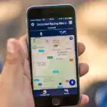
- Geographic Information Systems (GIS): GIS is a computer system designed to capture, store, manipulate, analyse, manage, and present all types of geographical data. It allows users to create interactive queries, analyse spatial information, edit data, maps, and present the results. GIS is widely used in urban planning, environmental management, resource allocation, and disaster management.
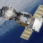
- Remote Sensing: Remote sensing is the acquisition of information about an object or phenomenon without making physical contact with the object, in contrast to on-site observation. This is typically done by using sensors on satellites or aircraft to detect and record energy reflected or emitted from the Earth’s surface. Examples include satellite imagery and aerial photography, used for land use mapping, weather forecasting, and environmental monitoring.
Teaching Methods/Instructional Techniques
Discussion, Demonstration, Guided Practice, Question and Answer, Explanation, Observation, Map Work, Group Work
Instructional Procedures
Step 1: Introduction
Time: 5 minutes
Teaching Skill: Engaging/Questioning
Teacher’s Activity: The teacher introduces the lesson by asking students what they understand by “Geography” and what tools they think geographers use to study the Earth. The teacher also briefly discusses the meaning of geography and its branches as a context for the tools.
Pupils’ Activity: Pupils respond to the questions and share their ideas about geography and its tools.
Learning Point: Geography concept link
Step 2: Identification of Map and Atlas
Time: 10 minutes
Teaching Skill: Demonstration/Observation
Teacher’s Activity: The teacher displays various maps (e.g., political, physical) and an atlas. The teacher guides students to identify these tools and discusses their basic features and uses, encouraging students to point out specific elements like legends, scales, and different types of maps within an atlas.
Pupils’ Activity: Pupils observe the maps and atlas, identify them, and discuss their features and uses in groups.
Learning Point: Map and atlas identification
Step 3: Identification of Globe and Compass
Time: 10 minutes
Teaching Skill: Demonstration/Practical
Teacher’s Activity: The teacher presents a globe and a compass. The teacher guides students to identify these tools, explaining the true representation of the Earth by the globe and demonstrating how to use the compass to find cardinal directions.
Pupils’ Activity: Pupils observe the globe and compass, identify them, and practice using the compass under teacher’s guidance.
Learning Point: Globe and compass identification
Step 4: Understanding Geographic Information Systems (GIS)
Time: 10 minutes
Teaching Skill: Explanation/Visualisation
Teacher’s Activity: The teacher explains what GIS is using images or a short video clip showing its application (e.g., mapping school facilities, planning routes). The teacher highlights that it’s a computer-based tool for managing and analysing spatial data.
Pupils’ Activity: Pupils listen to the explanation, watch the video/images, and ask questions for clarification.
Learning Point: GIS definition and use
Step 5: Exploring Remote Sensing
Time: 8 minutes
Teaching Skill: Explanation/Illustration
Teacher’s Activity: The teacher explains the concept of remote sensing, showing examples of satellite images or aerial photographs. The teacher discusses how information is gathered without physical contact and its uses in monitoring the environment.
Pupils’ Activity: Pupils observe the images, listen to the explanation, and contribute to the discussion on remote sensing applications.
Learning Point: Remote sensing explanation
Step 6: Application and Reinforcement
Time: 7 minutes
Teaching Skill: Group Work/Discussion
Teacher’s Activity: The teacher divides students into small groups and asks each group to discuss a real-life scenario where one or more of these geographic tools would be essential (e.g., planning a trip, studying deforestation, finding a location). The teacher monitors and provides guidance.
Pupils’ Activity: Pupils work in groups to discuss and present their scenarios and the tools needed.
Learning Point: Geographic tools application
Step 7: Evaluation/Review
Time: 5 minutes
Teaching Skill: Questioning/Assessment
Teacher’s Activity: The teacher evaluates the learning by asking the following questions:
- Mention three basic geographic tools you have learned today.
- What is the main difference between a map and a globe?
- How is a compass useful to a geographer?
- Briefly explain what GIS stands for and one of its uses.
Pupils’ Activity: Pupils answer orally and in writing.
Learning Point: Geographic tools identified
Step 8: Note-Taking
Time: 10 minutes
Teaching Skill: Guided Writing
Teacher’s Activity: The teacher guides pupils/students to copy the essential Board Summary notes on the types of geographic tools into their notebooks.
Pupils’ Activity: Pupils/students copy the notes carefully into their notebooks.
Learning Point: Tools of geography notes
Step 9: Conclusion
Time: 5 minutes
Teaching Skill: Summarising
Teacher’s Activity: The teacher summarises the lesson by reiterating the importance of geographic tools in understanding and interacting with the environment, encouraging students to explore these tools further.
Pupils’ Activity: Pupils listen attentively and ask any final questions.
Learning Point: Tools importance reinforced
Continuous Assessment/Further Study
Type: Homework
Instruction: Answer the following questions in your notebook:
- Define a map and an atlas, stating one key difference between them.
- Describe two practical uses of a compass in everyday life.
- Research and write a short paragraph on how remote sensing is used to monitor deforestation in Nigeria.
Lesson Keywords
- Map – A flat drawing of the Earth’s surface or a part of it.
- Atlas – A collection of maps in a book.
- Globe – A spherical model of the Earth.
- Compass – An instrument used to show direction.
- GIS (Geographic Information Systems) – A computer system for managing and analysing geographic data.
- Remote Sensing – Gathering information about Earth from a distance, typically using satellites or aircraft.
Differentiation
Support: For students who struggle, the teacher will provide simplified definitions and more direct examples of each tool, allowing them to focus on identifying rather than explaining. Practical demonstrations will be repeated as needed. Group activities will be structured to ensure all members contribute.
Extension: Advanced students can be challenged to research specific applications of GIS or remote sensing in Nigeria, or to compare the advantages and disadvantages of using a map versus a globe for different geographical tasks.
Suggested Lesson Videos
For further understanding, search on YouTube for:
- “Basic Geographic Tools for SS1”
- “Introduction to Maps, Globes, and Compasses”
- “What is GIS? Explained for beginners”
- “Remote Sensing explained”
Community Join the conversation Open discussion +