

Note for teachers using this lesson plan
This lesson plan introduces pupils to the concept of a region and the four early political regions of Nigeria. Teachers should prepare a clear, colourful historical map of Nigeria showing these regions. Emphasise interactive map work to help pupils visually identify and locate each region. By the end of the lesson, pupils should be able to explain what a region is and point out the early regions on a map.
Class: Primary 4
Term: Second Term
Week: 4
Age: 9 years
Duration: 45 minutes
Subject: Nigerian History
Curriculum Theme: Political Developments in Nigeria
Focal competence: Recognising and appreciating the changes in Nigeria’s political evolution
Key competencies/values: Collaboration; Information Literacy; ICT and Digital Competencies
Skills:
- Identification of the four regions
- Analyses of the reasons for creation of four regions
Previous Lesson: Reasons for Changes in Colonial Headquarters and Their Effects on Nigeria
Topic: The Early Regions In Nigeria
Subject Matter: Meaning of a region, Names and locations of the four early regions in Nigeria
Specific Objectives
By the end of the lesson, pupils should be able to:
Cognitive Domain
- Explain the meaning of a region.
- Identify the four early regions in Nigeria.
Psychomotor Domain
- Identify the locations of each region on the map of Nigeria.
Reference Materials
The following resources were used in planning this lesson:
- 2025 Revised 9 Years Basic Education Curriculum
- Relevant State Unified Scheme of Work
- Macmillan Primary Social Studies for Primary 4
- The HeadTeacher Scheme of work
Instructional Materials
The teacher will teach this lesson with the aid of:
- Map of Nigeria (historical map showing early regions)
- Charts showing the names of the early regions
- Video clips/documentaries (if available and relevant)
- Textbooks
Rationale for the Lesson
Understanding the early regions of Nigeria is fundamental to grasping the country’s political structure and evolution. This lesson helps pupils appreciate how Nigeria was organised in its early stages, laying a foundation for understanding current administrative divisions and the history of governance in Nigeria.
Prerequisite/Previous Knowledge
Pupils have basic knowledge of Nigeria as a country and can identify its geographical shape on a map.
Lesson Content/Board Summary
The Early Regions In Nigeria
Meaning of a Region
A region is a large area of land that has common features such as climate, geography, culture, or political administration. In the context of early Nigeria, a region was a large administrative area with its own government, created before Nigeria became fully independent.
The Four Early Regions of Nigeria
After the amalgamation of Northern and Southern Protectorates in 1914, Nigeria was eventually divided into four main administrative regions. These regions were:
- The Northern Region
- The Western Region
- The Eastern Region
- The Mid-Western Region (created later from the Western Region)
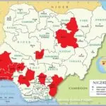
Locations of the Early Regions on the Map of Nigeria
The four early regions covered distinct geographical areas of Nigeria:
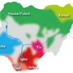
- Northern Region: This region covered the vast northern part of Nigeria, including areas predominantly inhabited by Hausa, Fulani, Nupe, Tiv, and other northern ethnic groups. Its capital was Kaduna.
- Western Region: This region covered the southwestern part of Nigeria, largely inhabited by the Yoruba people. Its capital was Ibadan.
- Eastern Region: This region covered the southeastern part of Nigeria, largely inhabited by the Igbo, Ibibio, Efik, and other eastern ethnic groups. Its capital was Enugu.
- Mid-Western Region: This region was later carved out of the Western Region in 1963. It covered areas inhabited by the Edo, Urhobo, Itsekiri, and other ethnic groups in the present-day Edo and Delta states. Its capital was Benin City.
Teaching Methods/Instructional Techniques
Discussion, Explanation, Question and Answer, Map Work, Group Work, Observation
Instructional Procedures
Step 1: Introduction
Time: 5 minutes
Teaching Skill: Activating prior knowledge
Teacher’s Activity: The teacher greets the pupils and asks them to name their country. The teacher then asks if they know how Nigeria was governed a long time ago.
Pupils’ Activity: Pupils respond by naming Nigeria and sharing what they know about its governance.
Learning Point: Nigeria’s past governance
Step 2: Explanation of a Region
Time: 7 minutes
Teaching Skill: Explaining/Defining
Teacher’s Activity: The teacher explains the meaning of a “region” as a large area with common features or administrative structure. The teacher uses simple examples to illustrate.
Pupils’ Activity: Pupils listen attentively and ask questions for clarification.
Learning Point: Meaning of region
Step 3: Introduction to Early Regions of Nigeria
Time: 7 minutes
Teaching Skill: Introducing concept
Teacher’s Activity: The teacher introduces the concept of Nigeria being divided into early regions for administrative purposes after amalgamation, using the historical map of Nigeria.
Pupils’ Activity: Pupils observe the map and listen to the teacher’s explanation.
Learning Point: Early Nigerian regions
Step 4: Naming the Four Early Regions
Time: 7 minutes
Teaching Skill: Listing/Identification
Teacher’s Activity: The teacher explicitly names the four early regions: Northern, Western, Eastern, and Mid-Western, writing them on the board and showing them on a chart.
Pupils’ Activity: Pupils repeat the names of the regions after the teacher and observe the chart.
Learning Point: Names of regions
Step 5: Locating Regions on the Map
Time: 7 minutes
Teaching Skill: Demonstration/Map work
Teacher’s Activity: The teacher uses the historical map of Nigeria to point out and describe the geographical location of each of the four early regions.
Pupils’ Activity: Pupils observe the map and pay attention to the locations of each region.
Learning Point: Regional map locations
Step 6: Guided Identification and Naming
Time: 4 minutes
Teaching Skill: Guided practice
Teacher’s Activity: The teacher invites pupils, in turns, to come to the map and point to and name each of the four early regions.
Pupils’ Activity: Pupils volunteer to identify and name the regions on the map.
Learning Point: Identifying regions on map
Step 7: Evaluation/Review
Time: 5 minutes
Teaching Skill: Questioning/Assessment
Teacher’s Activity: The teacher evaluates the learning by asking the following questions:
- What is a region?
- Name two of the early regions of Nigeria.
- Point to the Eastern Region on the map.
Pupils’ Activity: Pupils answer orally and in writing.
Learning Point: Understanding early regions
Step 8: Note-Taking
Time: 4 minutes
Teaching Skill: Guided Writing
Teacher’s Activity: The teacher guides pupils to copy the essential Board Summary notes on the meaning of a region and the names/locations of the early regions into their notebooks.
Pupils’ Activity: Pupils copy the notes carefully into their notebooks.
Learning Point: Recording lesson notes
Step 9: Conclusion
Time: 2 minutes
Teaching Skill: Summarising
Teacher’s Activity: The teacher briefly reminds pupils about the importance of knowing Nigeria’s history and the early regions. The teacher praises pupils for their participation.
Pupils’ Activity: Pupils listen and affirm their understanding.
Learning Point: Historical regions importance
Continuous Assessment/Further Study
Type: Homework
Instruction: Answer the following questions in your notebook.
- Define “region” in your own words.
- List the four early regions of Nigeria.
- Draw a simple sketch map of Nigeria and try to indicate the approximate location of the Northern and Western Regions.
Lesson Keywords
- Region – A large area of land with common features or administrative boundaries.
- Northern Region – One of Nigeria’s early administrative areas, located in the northern part of the country.
- Western Region – One of Nigeria’s early administrative areas, located in the southwestern part of the country.
- Eastern Region – One of Nigeria’s early administrative areas, located in the southeastern part of the country.
- Mid-Western Region – An early administrative area carved out of the Western Region in 1963.
Differentiation
For weaker learners: Provide pre-labelled maps of Nigeria with the regions clearly marked for easier identification. Focus on identifying just two regions initially.
For faster learners: Encourage them to research the capitals of each region and the year the Mid-Western Region was created.
Suggested Lesson Videos
Search on YouTube for: “Early Regions of Nigeria Primary 4 History”
Teacher Guide for Using This Lesson Plan
Before the lesson, ensure you have a clear, large historical map of Nigeria showing the four early regions. You may also prepare charts with the names of the regions. Begin by engaging pupils with questions about Nigeria to activate their prior knowledge. Clearly explain the meaning of a region before introducing the specific early regions of Nigeria. Use the map extensively, pointing out each region and its general location. Encourage pupils to come forward and identify the regions themselves. During note-taking, ensure pupils copy the Board Summary accurately. For assessment, ask questions directly related to the meaning of a region and the names/locations of the early regions. Provide support for pupils who struggle with map identification and challenge faster learners with additional facts.

Community Join the conversation Open discussion +