

Class: Primary 4
Term: 2nd term
Subject: National Values Education
Curriculum Theme: Civic Education
Previous Lesson: Characteristics Of A Nation
Topic: What Makes Up a Nation
Content/Learning Area: Geo-political regions,states,and local government areas.
Time Allocation: 40 minutes
Performance Objectives
By the end of the lesson, pupils should be able to:
- Cognitive domain: Identify the three geo-political components of a nation (regions, states, and local government areas).
- Affective Domain: Appreciate the importance of each geo-political unit in the unity of a nation.
- Psychomotor Domain: Illustrate the geo-political map of Nigeria showing states and regions.
- Social Domain: discuss with classmates the role of local governments in nation-building.
Reference Materials
The following resources were used in planning this lesson:
- 9–Years Basic Education curriculum
- Abuja Educational Resource Center Scheme of Work
- NAPPS National Unified Scheme of Work
- Online information from Nature – What Constitutes a Nation?
- Relevant textbooks
Instructional Materials
To deliver this lesson, the teacher will use the following materials:
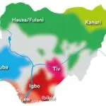
- A chart of Nigeria showing regions, states, and local governments.
- A globe or map of Africa.
- Flashcards with key terms (regions, states, local governments).
Rationale for the Lesson
Understanding the components of a nation is vital as it helps pupils grasp the structure and functions of their country, fostering national unity and patriotism.
Prerequisite/Previous knowledge
Pupils have basic knowledge of the characteristics of a nation and can identify nigeria on a map.
Lesson Content
What Makes Up a Nation
A nation is made up of various parts that work together to ensure its unity and growth. These include:
- Geo-political Regions: Divisions that represent large areas, like the North, East, and West of Nigeria.
- States: Nigeria has 36 states, each with unique cultures and resources.
- Local Government Areas: Smaller administrative units within states, closer to the people.
- People: The diverse ethnic groups, languages, and traditions that define the nation.
- Resources: Natural and human resources that support the nation’s growth.
People, Territory and Government
A nation includes people with a sense of belonging, a recognised territory, organised government, laws and institutions. It may also have shared history and national symbols while containing many languages, ethnic groups and religions.
Nigeria has 36 states and the Federal Capital Territory, grouped for discussion into six geopolitical zones; these zones are not a separate tier of government. Local government areas form the third tier beneath federal and state government.
Teaching Methods
To deliver this lesson, the teacher will adopt the following methods: Lecture, Discussion, Presentation, Visual aids, Guided discovery, Questioning.
Instructional Procedures
To deliver this lesson, the teacher will adopt the following steps:
Step 1: Introduction
Time: 5 mins
Teaching Skill: Set Induction
Teacher’s Activity: Ask pupils to name a few states in Nigeria and identify them on a map.
Pupils’ Activity: Respond to questions and point to the map.
Step 2: Explanation of Geo-Political Regions
Time: 10 mins
Teaching Skill: Explanation
Teacher’s Activity: Explain geo-political regions, states, and local governments using a chart.
Pupils’ Activity: Listen attentively and observe the chart.
Step 3: Identification of State and Local Government
Time: 7 mins
Teaching Skill: Demonstration
Teacher’s Activity: Guide pupils to identify their state and local government.
Pupils’ Activity: Point to their state and local government on the map.
Step 4: Note-Taking
Time: 5 mins
teaching Skill: Writing
Teacher’s Activity: Write notes on the board for pupils to copy.
Pupils’ Activity: Copy notes neatly.
Step 5: Evaluation/Review
Time: 5 mins
Teaching Skill: Questioning
Teacher’s Activity: Ask questions to assess understanding.
Pupils’ Activity: Answer questions orally.
Step 6: Conclusion
Time: 3 mins
Teaching Skill: Recap
Teacher’s Activity: Summarize the lesson and highlight key points.
Pupils’ Activity: listen to the summary.
Lesson Keywords
- Geo-political Regions – Large areas representing divisions within a nation.
- states – Administrative divisions with unique cultures and resources.
- Local Government Areas – Smaller administrative units within states.
- Nation – A large body of people united by common descent, history, culture, or language, inhabiting a particular country or territory.
- Unity – The state of being united or joined as a whole.
Lesson Evaluation
To evaluate the learning, the teacher asks pupils to:
- List the three main geo-political units in a nation.
- Explain the role of local governments in a country.
- Name their state and local government.
- Why are regions vital in national unity?
- How many states does Nigeria have?
Assignment/Homework
- Draw the map of Nigeria and label your state and local government area.
- Write a short paragraph on the importance of your local government to the community.
- List three functions of the state government.
Differentiation
- For slower learners: Provide simplified charts and one-on-one assistance to identify their state and local government.
- For advanced learners: Research and present on the history and significance of their state.
- For visual/auditory/kinesthetic learners: Use maps,songs,and physical activities to reinforce learning.
Note for Teachers
Use colorful and interactive visual aids to keep the pupils engaged. Encourage them to relate the lesson to their immediate environment for better understanding. Happy teaching!
Community Join the conversation Open discussion +