

Class: Senior Secondary School 2 (SS2 / SSS 2)
Term: 3rd Term
Week: 1
Age: 16 years
Duration: 45 minutes
Subject: Geography
Curriculum Theme: Geographical Skills
Previous Lesson: .
Topic: Map Reading
Subject Matter: Direction and bearing, major cardinal points, true north and magnetic north, magnetic variation, compass direction, angular bearings, determining directions and bearings from topographical maps
Specific Objectives
By the end of the lesson, pupils should be able to:
Cognitive Domain:
- Define direction and bearing.
- Identify the major cardinal points and intermediate points.
- Explain the difference between true north, magnetic north, and grid north.
- Calculate angular bearings from a given map.
- Determine directions and bearings from topographical maps.
Affective Domain:
- Appreciate the importance of accurate direction and bearing in daily life.
- Participate actively in discussions about map reading.
Psychomotor Domain:
- Draw diagrams illustrating major cardinal points and angular bearings.
- Measure bearings accurately using a protractor on a map.
Social Domain:
- Collaborate with peers to solve problems related to map reading.
Reference Materials
The following resources were used in planning this lesson:
- 9 Years Basic Education Curriculum for Geography.
- State Unified Scheme of Work for Senior Secondary Geography.
- Adeleke, B. O. (2018). Essential Geography for Senior Secondary Schools. Tonad Publishers.
- https://geography.name/map-reading-direction-and-bearing/
- https://www.youtube.com/watch?v=R915cQ-tV7o
Instructional Materials
The teacher will teach this lesson with the aid of:
- Topographical maps
- Atlas
- Plans
- Compass
- Protractor
- Ruler
Rationale for the Lesson
This lesson helps pupils understand how to read and interpret maps, which is an important skill for navigation and understanding geographical information. Knowing how to determine direction and bearing enables pupils to locate places accurately and interpret spatial relationships in their environment.
Prerequisite/Previous Knowledge
Pupils have prior knowledge of basic map concepts, cardinal points, and how to use a compass from previous lessons.
Lesson Content/Board Summary
Map Reading: Direction and Bearing
Direction and Bearing
Direction refers to the position of one place relative to another. It indicates where something is located in relation to a reference point.
Bearing is the angle measured clockwise from a fixed reference line (usually North) to a specific point or direction. Bearings are typically expressed in three figures (e.g., 045°, 180°, 270°).
Major Cardinal Points
The Earth’s surface has four main cardinal directions and four intermediate directions.
The major cardinal points are:
- North (N)
- East (E)
- South (S)
- West (W)
The intermediate cardinal points are:
- North-East (NE)
- South-East (SE)
- South-West (SW)
- North-West (NW)
True North and Magnetic North
True North is the direction of the Earth’s geographic North Pole. It is a fixed point and is used as the standard reference for map bearings. Lines of longitude on a map point towards True North.
Magnetic North is the direction that a compass needle points to, which is the Earth’s magnetic North Pole. This pole is not fixed; it shifts over time and is different from the geographic North Pole.
Grid North is the direction of the north-south grid lines on a map. On large-scale maps, grid lines are parallel to True North at the central meridian of the map projection.
Magnetic Variation
Magnetic variation (or declination) is the angular difference between True North and Magnetic North at a specific location. It varies from place to place and changes over time. It is usually indicated on topographical maps.
NOTE: When converting between true and magnetic bearings, add the magnetic variation if Magnetic North is East of True North, and subtract if Magnetic North is West of True North.
Compass Direction
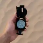
Compass direction refers to the use of a compass to determine direction relative to Magnetic North. A compass is a navigational instrument that shows direction relative to the geographic cardinal directions, typically North, South, East, and West.
Angular Bearings
Angular bearings are precise directions measured in degrees clockwise from a reference North line.
There are three main types of angular bearings:
- True Bearing (TB): Measured clockwise from True North.
- Magnetic Bearing (MB): Measured clockwise from Magnetic North.
- Grid Bearing (GB): Measured clockwise from Grid North.
How to measure a True Bearing on a map:
- Locate the starting point (A) and the destination point (B) on the map.
- Draw a straight line connecting point A to point B.
- From point A, draw a line pointing towards True North (a line parallel to the map’s grid north lines or a meridian).
- Place the protractor’s center at point A, aligning its 0° mark with the True North line.
- Measure the angle clockwise from the True North line to the line AB.
- Record the angle in three figures.
Example 1: Measuring True Bearing
A pupil wants to find the true bearing of Point B from Point A on a map.
Steps:
- Draw Line: Draw a straight line from Point A to Point B.
- Draw North Line: Draw a True North line originating from Point A.
- Measure Angle: Using a protractor, measure the angle clockwise from the True North line to the line AB.
- Result: If the measured angle is 45 degrees, the True Bearing of B from A is 045°.
Example 2: Measuring True Bearing (Reflex Angle)
A pupil wants to find the true bearing of Point D from Point C on a map, where D is to the south-west of C.
Steps:
- Draw Line: Draw a straight line from Point C to Point D.
- Draw North Line: Draw a True North line originating from Point C.
- Measure Angle: Using a protractor, measure the angle clockwise from the True North line to the line CD. This angle will be greater than 180°.
- Result: If the measured angle is 225 degrees, the True Bearing of D from C is 225°.
Determining Directions and Bearings from Topographical Maps
Topographical maps provide detailed information about relief and features, making them suitable for determining precise directions and bearings.
Steps to determine bearings from topographical maps:
- Identify Points: Clearly mark the starting point (e.g., a village) and the destination point (e.g., a hill) on the map.
- Draw a Join Line: Draw a straight line connecting the centre of the starting point to the centre of the destination point.
- Draw a North Line: From the starting point, draw a line pointing towards the required North (True North, Grid North, or Magnetic North, depending on the question). Usually, Grid North is used as it aligns with the vertical grid lines.
- Measure the Angle: Place a protractor with its centre on the starting point and its 0° mark aligned with the North line. Measure the angle clockwise from the North line to the join line.
- State the Bearing: Express the measured angle as a three-figure bearing (e.g., 090° for East, 180° for South).
NOTE: Always ensure your protractor is correctly aligned and measure clockwise. The North line is your reference.
Teaching Methods/Instructional Techniques
Discussion, Lecture, Demonstration, Question and Answer, Visual Aids
Instructional Procedures
Step 1: Introduction
Time: 5 minutes
Teaching Skill: Set Induction
Teacher’s Activity: The teacher greets the pupils and asks them about their understanding of directions and how they find their way to school or other places. The teacher then introduces the topic: Map Reading, focusing on Direction and Bearing.
Pupils’ Activity: Pupils respond to the teacher’s questions and listen attentively to the introduction of the new topic.
Learning Point: Pupils are engaged and the lesson is linked to their prior knowledge and daily experiences.
Step 2: Direction and Major Cardinal Points
Time: 7 minutes
Teaching Skill: Explanation/Demonstration
Teacher’s Activity: The teacher explains what direction is and introduces the major cardinal points (North, East, South, West) and intermediate points (NE, SE, SW, NW), drawing a diagram on the board. The teacher uses a compass to demonstrate how to locate these directions.
Pupils’ Activity: Pupils listen, draw the cardinal points in their notebooks, and identify directions using a compass.
Learning Point: Pupils understand and can identify major cardinal and intermediate points.
Step 3: True North, Magnetic North, and Magnetic Variation
Time: 8 minutes
Teaching Skill: Explanation/Illustration
Teacher’s Activity: The teacher explains the concepts of True North, Magnetic North, and Grid North, highlighting their differences. The teacher also defines magnetic variation and explains why it is important to consider it when using a compass and map together.
Pupils’ Activity: Pupils listen, ask questions for clarification, and take notes.
Learning Point: Pupils understand the different types of North and the concept of magnetic variation.
Step 4: Compass Direction and Angular Bearings
Time: 8 minutes
Teaching Skill: Explanation/Demonstration
Teacher’s Activity: The teacher explains what compass direction is. The teacher then defines angular bearings and explains the three types (True Bearing, Magnetic Bearing, Grid Bearing). Using a diagram on the board and a topographical map, the teacher demonstrates how to measure angular bearings clockwise from the North line, providing examples.
Pupils’ Activity: Pupils observe the demonstration, take notes, and ask questions about the measurement process.
Learning Point: Pupils understand angular bearings and the basic method of measurement.
Step 5: Determining Directions and Bearings from Topographical Maps
Time: 7 minutes
Teaching Skill: Guided Practice/Demonstration
Teacher’s Activity: The teacher guides pupils through the step-by-step process of determining directions and bearings using a topographical map, ruler, and protractor. The teacher provides a practical example on a projected map or a large map displayed in the classroom.
Pupils’ Activity: Pupils follow along with the teacher’s demonstration, identifying points and mentally or physically tracing lines and angles on their own maps if available.
Learning Point: Pupils learn the practical steps for determining bearings from a map.
Step 6: Class Activity/Practice
Time: 5 minutes
Teaching Skill: Collaborative Learning/Application
Teacher’s Activity: The teacher distributes topographical maps to groups of pupils and gives them specific tasks to determine the bearing of one feature from another. The teacher monitors and provides assistance.
Pupils’ Activity: Pupils work in groups to practice measuring bearings from the topographical maps.
Learning Point: Pupils apply their understanding by practicing bearing measurement.
Step 7: Evaluation/Review
Time: 5 minutes
Teaching Skill: Questioning/Assessment
Teacher’s Activity: The teacher evaluates the learning by asking the following questions:
- Define direction and bearing.
- List the four major cardinal points.
- Explain the difference between True North and Magnetic North.
- How would you determine the true bearing of a school from a market on a topographical map?
Pupils’ Activity: Pupils answer orally and in writing.
Learning Point: Pupils demonstrate understanding of the lesson.
Step 8: Conclusion
Time: 2 minutes
Teaching Skill: Summarization
Teacher’s Activity: The teacher summarizes the key points of the lesson, emphasizing the importance of accurate map reading for navigation and geographical understanding. The teacher assigns homework: Measure the true bearing of your home from your school using a local map or sketch.
Pupils’ Activity: Pupils listen to the summary and copy down the homework assignment.
Learning Point: Pupils consolidate their learning and are given an opportunity to apply the knowledge at home.
Lesson Keywords
- Direction – The position of one place relative to another.
- Bearing – The angle measured clockwise from a fixed reference line (usually North) to a specific point or direction.
- Cardinal Points – The four main directions: North, East, South, West.
- True North – The direction of the Earth’s geographic North Pole.
- Magnetic North – The direction a compass needle points to.
- Magnetic Variation – The angular difference between True North and Magnetic North.
- Angular Bearing – A precise direction measured in degrees clockwise from a North line.
- Topographical Map – A map showing detailed surface features and relief.
Differentiation
For pupils who grasp concepts quickly, the teacher will provide more complex topographical map exercises involving converting between different types of bearings. For pupils needing additional support, the teacher will provide simplified maps and one-on-one guidance, focusing on identifying cardinal points and basic bearing measurement.
Note for teachers using this lesson plan
Teachers should ensure they have adequate topographical maps, compasses, rulers, and protractors for practical demonstrations and pupil activities. Emphasize the practical application of map reading skills. Encourage pupils to draw and measure accurately. Safety precautions should be taken if using actual compasses in the field.


Community Join the conversation Open discussion +