

Class: Senior Secondary School 2 (SS2 / SSS2)
Term: 1st Term
Week: 1
Age: 16 years
Duration: 45 minutes
Subject: Geography
Curriculum Theme: Coastal Geomorphology
Previous Lesson: .
Topic: Action of Waves
Subject Matter: Definition of waves and related terms such as tide, currents, coast and swash, erosional processes of waves such as corrosion, attrition, solution and hydraulic action, erosional features such as cape, bay, cliff, caves and stack, coastal deposition features such as beaches, spit and bar.
Specific Objectives
By the end of the lesson, pupils should be able to:
Cognitive Domain:
- Define waves and related terms such as tide, currents, coast, and swash.
- Explain the erosional processes of waves, including corrosion, attrition, solution, and hydraulic action.
- Identify and describe major erosional features such as cape, bay, cliff, caves, and stack.
- Identify and describe major depositional features such as beaches, spit, and bar.
Affective Domain:
- Appreciate the dynamic nature of coastal environments.
- Show interest in the formation and changes of coastal landforms.
- Recognize the importance of understanding wave action on coastal areas.
Psychomotor Domain:
- Draw annotated diagrams of coastal erosional and depositional landforms.
- Observe and identify coastal landforms during a guided tour or from visual aids.
Social Domain:
- Participate actively in class discussions on wave action and coastal features.
- Collaborate with peers to identify and describe various coastal landforms.
Reference Materials
The following resources were used in planning this lesson:
- 9 Years Basic Education Curriculum for Senior Secondary Schools (Geography).
- State Unified Scheme of Work for Senior Secondary School Geography.
- Adeleke, B.O. (2012). Essential Geography for Senior Secondary Schools. Tonad Publishers.
Instructional Materials
The teacher will teach this lesson with the aid of:
- Films
- Pictures
- Models
- Slides
- Sketches
- Annotated diagrams of coastal landforms
Rationale for the Lesson
Understanding the action of waves helps pupils know how coastlines are shaped and changed over time. This knowledge is important for appreciating the environment around them and understanding the forces that affect coastal communities and resources.
Prerequisite/Previous Knowledge
Pupils have prior knowledge of water bodies and basic landforms from their junior secondary geography lessons.
Lesson Content/Board Summary
Action of Waves
Definition of Waves and Related Terms
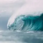
Waves: These are oscillations or disturbances that transfer energy through water, often generated by wind blowing over the water surface.
Tide: The periodic rise and fall of sea level, primarily caused by the gravitational pull of the Moon and Sun on the Earth’s oceans.
Currents: Continuous, directed movement of ocean water, generated by forces acting upon the mean flow, such as breaking waves, wind, the Coriolis effect, and temperature and salinity differences.
Coast: The area where land meets the sea or ocean, extending both inland and offshore.
Swash: The turbulent layer of water that washes up the beach after a wave has broken.
Erosional Processes of Waves
Waves erode coastlines through several processes:
- Corrosion (Abrasion): This is the grinding away of the coastline by rock fragments carried by the waves. These fragments are hurled against the cliff face, wearing it down.
- Attrition: This is the process where rock fragments carried by the waves collide with each other and become smaller and more rounded.
- Solution: This involves the dissolving of soluble rocks (like limestone) by the chemical action of seawater.
- Hydraulic Action: This occurs when the force of waves compresses air into cracks and crevices in the rock. As the wave retreats, the compressed air expands explosively, widening the cracks and breaking off pieces of rock.
Erosional Features of Waves
Wave erosion creates distinct landforms along the coast. Some common erosional features include:
- Cape: A high point of land or a headland that projects into the sea.
- Bay: A broad, curved indentation of the coastline between two headlands, often with a beach.
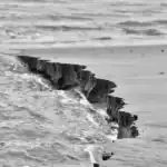
- Cliff: A steep rock face, especially at the edge of the sea.
- Caves: Hollows formed at the base of cliffs where weak points in the rock have been eroded by wave action.
- Stack: A column of rock standing in the sea, isolated from the coastline, formed when an arch collapses.
Coastal Deposition Features of Waves
Where wave energy is lower, waves deposit sediments to form landforms. Common depositional features include:
- Beaches: Accumulations of sand, shingle, or pebbles found at the coast, formed by the deposition of material carried by waves.
- Spit: A long, narrow ridge of sand or shingle projecting from the land into the sea, often with a curved end, formed by longshore drift.
- Bar: A ridge of sand or shingle that connects two headlands or encloses a bay, formed when a spit extends across a bay.
Teaching Methods/Instructional Techniques
Discussion, Lecture, Demonstration, Question and Answer, Visual Aids
Instructional Procedures
Step 1: Introduction
Time: 5 minutes
Teaching Skill: Set Induction
Teacher’s Activity: The teacher greets the pupils and asks them what they know about the sea or ocean, and what they observe happening to the shoreline. The teacher then introduces the topic: “Action of Waves.”
Pupils’ Activity: Pupils respond to the teacher’s questions and listen attentively to the introduction.
Learning Point: Pupils are prepared for the lesson and understand the topic of discussion.
Step 2: Explanation of Waves and Related Terms
Time: 10 minutes
Teaching Skill: Explanation/Demonstration
Teacher’s Activity: The teacher uses pictures, films, or models to explain the meaning and characteristics of waves, tides, currents, coast, and swash. The teacher ensures pupils grasp these fundamental terms.
Pupils’ Activity: Pupils observe the visual aids, listen to the explanations, and ask questions for clarification.
Learning Point: Pupils define waves, tide, currents, coast, and swash.
Step 3: Discussion of Erosional Processes
Time: 10 minutes
Teaching Skill: Guided Discussion
Teacher’s Activity: The teacher guides a discussion on the erosional processes of waves, explaining corrosion (abrasion), attrition, solution, and hydraulic action with examples.
Pupils’ Activity: Pupils participate in the discussion, offer examples, and explain each erosional process in their own words.
Learning Point: Pupils explain the erosional processes of waves.
Step 4: Identification of Erosional Features
Time: 5 minutes
Teaching Skill: Visual Identification/Description
Teacher’s Activity: The teacher displays pictures, slides, or annotated diagrams of coastal erosional features such as cape, bay, cliff, caves, and stack, helping pupils to identify and describe them.
Pupils’ Activity: Pupils identify and describe the various erosional features shown by the teacher.
Learning Point: Pupils identify and describe major erosional features of waves.
Step 5: Identification of Depositional Features
Time: 5 minutes
Teaching Skill: Visual Identification/Description
Teacher’s Activity: The teacher presents pictures, slides, or annotated diagrams of coastal depositional features such as beaches, spit, and bar, guiding pupils to identify and describe them.
Pupils’ Activity: Pupils identify and describe the various depositional features presented.
Learning Point: Pupils identify and describe major depositional features of waves.
Step 6: Diagramming Coastal Landforms
Time: 5 minutes
Teaching Skill: Demonstration/Practical Activity
Teacher’s Activity: The teacher demonstrates how to draw simple annotated diagrams of one or two key coastal landforms (e.g., cliff with cave and stack, or a spit). The teacher encourages pupils to practice drawing.
Pupils’ Activity: Pupils attempt to draw annotated diagrams of coastal landforms in their notebooks.
Learning Point: Pupils develop skills in drawing annotated diagrams of coastal landforms.
Step 7: Evaluation/Review
Time: 5 minutes
Teaching Skill: Questioning/Assessment
Teacher’s Activity: The teacher evaluates the learning by asking the following questions:
- Define waves and any two related terms.
- List and explain two erosional processes of waves.
- Mention three erosional features formed by wave action.
- Describe how a spit is formed.
Pupils’ Activity: Pupils answer orally and in writing.
Learning Point: Pupils demonstrate understanding of the lesson.
Step 8: Conclusion
Time: 1 minute
Teaching Skill: Summarization
Teacher’s Activity: The teacher briefly summarizes the key points of the lesson, emphasizing the importance of wave action in shaping coastlines.
Pupils’ Activity: Pupils listen to the summary and prepare for the next lesson.
Learning Point: Pupils consolidate their understanding of the lesson.
Lesson Keywords
- Waves – Oscillations or disturbances that transfer energy through water.
- Tide – The periodic rise and fall of sea level caused by gravitational forces.
- Currents – Continuous, directed movements of ocean water.
- Coast – The area where land meets the sea or ocean.
- Swash – The turbulent water that washes up a beach after a wave breaks.
- Corrosion (Abrasion) – The grinding away of the coastline by rock fragments carried by waves.
- Attrition – The process where rock fragments carried by waves collide and become smaller.
- Solution – The dissolving of soluble rocks by seawater.
- Hydraulic Action – The force of waves compressing and decompressing air in cracks, breaking rocks.
- Cape – A high point of land or headland projecting into the sea.
- Bay – A broad, curved indentation of the coastline.
- Cliff – A steep rock face at the edge of the sea.
- Caves – Hollows formed at the base of cliffs by wave erosion.
- Stack – A column of rock standing in the sea, isolated from the coastline.
- Beaches – Accumulations of sand, shingle, or pebbles at the coast.
- Spit – A narrow ridge of sand or shingle projecting from the land into the sea.
- Bar – A ridge of sand or shingle that connects two headlands or encloses a bay.
Differentiation
For pupils who grasp concepts quickly, the teacher can encourage them to research and present on local examples of wave action or the impact of climate change on coastal features. For pupils needing additional support, the teacher can provide simplified diagrams, extra explanations, and more direct guidance during drawing activities.
Note for teachers using this lesson plan
Teachers should ensure they have appropriate visual aids (pictures, videos, models) readily available to effectively demonstrate the various processes and features. Where possible, a virtual field trip or actual observation of a nearby coast can greatly enhance pupil understanding. Encourage pupils to relate the concepts to real-world scenarios and local environments.

Community Join the conversation Open discussion +